

Airports
Know the airport before you land.
Terminal maps with the gates drawn in, how the airport is running, the weather, lounges and the way into town, for every airport you fly through.
- Maps free
- Worldwide
- Boards: Plus
Status and weather
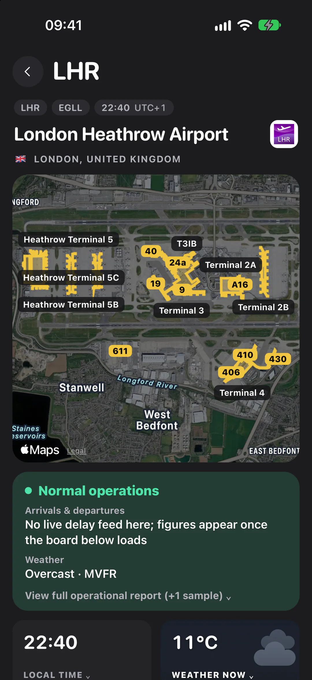
Green means all is well.
The first card under the map turns amber or red only on live evidence: the FAA's programs and alerts at US airports, the board's late and cancelled flights, or fog thick enough to slow arrivals.
- FAA programs and alerts at US airports, with their source
- The latest METAR, decoded, with the time it was taken
- The board's late and cancelled share, once it has loaded
How it's running
- Normal operations
- Some disruption
- Major disruption
Weather · flight category
- VFRGood visibility and high or no cloud
- MVFRLower cloud or some haze
- IFRLow cloud or poor visibility: aircraft fly by instruments
- LIFRVery low cloud or fog: arrivals may be slowed
Terminal maps
Every gate, on the map.
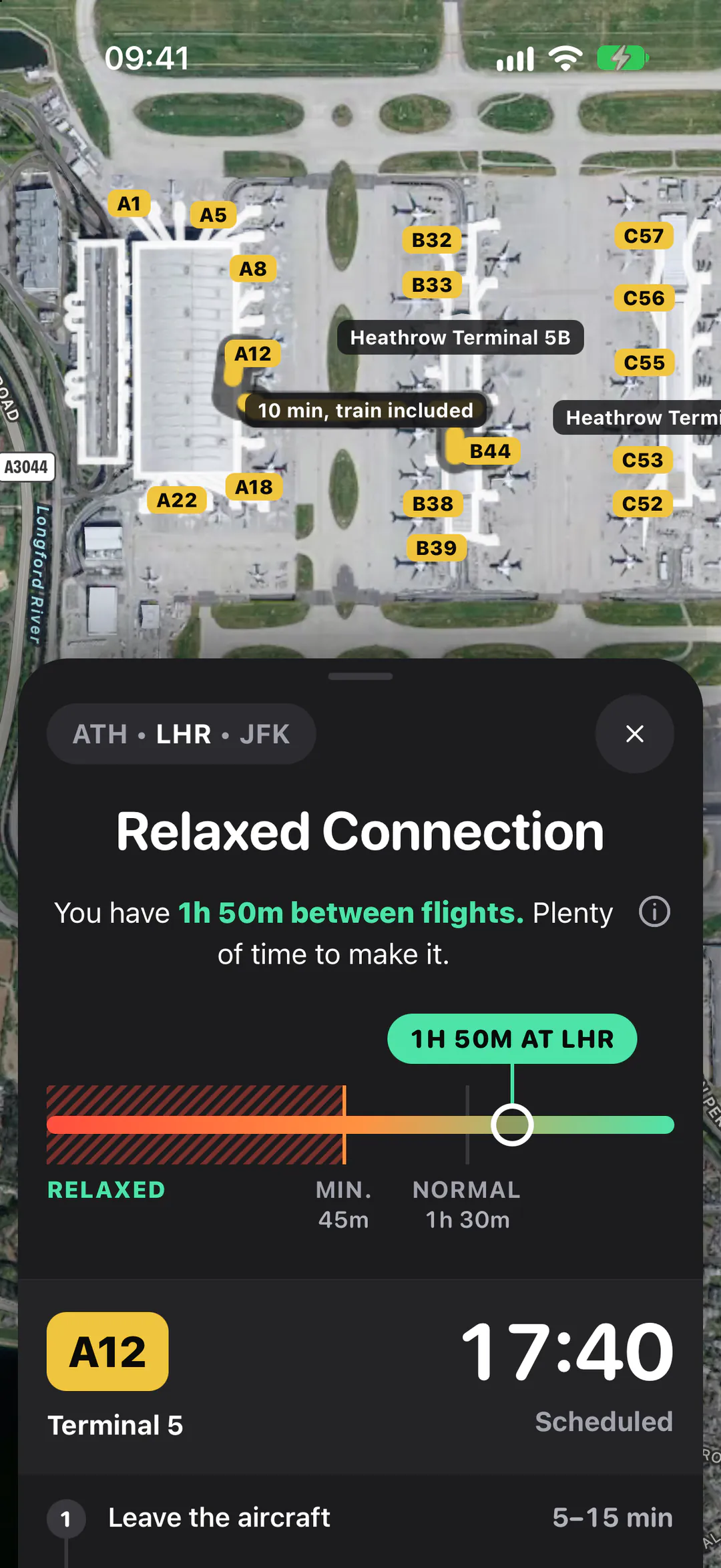
A satellite view of the airport with the terminals in wayfinding yellow and as many gate numbers as fit, then each building with its gates listed underneath.
- Terminals and gates from OpenStreetMap
- A connection's walk, gate to gate, on the same map
- Free at every airport that's mapped
Getting there
Into town, and back.
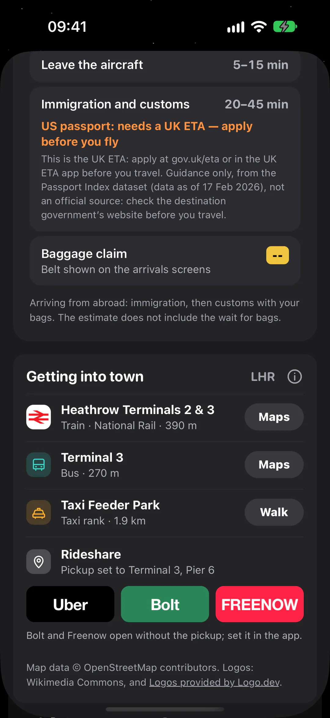
The trains, buses and coaches that call at the airport, with the stop nearest the terminals and how far it is, and the ride apps that actually run in that country.
- Train services and bus operators, with their routes
- Next departures where the transit agency publishes them
- Ride apps to the airport and from it, most used firstPlus
33 ride appsride apps
126 countriescountries
- JapanGO · S.RIDE · Uber
- SingaporeGrab · Gojek · CDG Zig
- United Arab EmiratesCareem · Uber · Yango
- IndiaUber · Ola · Rapido
- MexicoUber · DiDi · inDrive
On every airport page
The board, the lounges, who to call.
The rest of what you'd want to know about a field you're flying through.
- Plus
Departures and arrivals
The next dozen flights each way, gate or belt, status in plain words, and estimates in colour. Show all opens the next eleven hours.
Gate B44 gate (sample figure)
- Plus
On-time figures
On time, late and cancelled across the board's hours, the average delay hour by hour, and the routes and airlines having the worst of it.
- Pro
Lounges
The lounges mapped at the airport, free to see. Then whether you get in free from your cards, memberships and status on the flight you're on, with the reasons, and a day pass where you don't.
Contacts
The airport's and airlines' phone numbers, only ones checked by hand on the publisher's own page. Most airports have none checked yet.
Local time
The clock at the airport, how far it is from yours, and the next sunrise or sunset there.
Spotter mode
Switch it on in Settings for the runways, the ATC frequencies and the places people watch from.
Questions
About airports.
Which airports does Squawk cover?
Airports with scheduled service, worldwide. How much a page shows depends on its sources: the FAA covers US airports, and terminal maps, transit and lounges come from OpenStreetMap, whose detail varies from airport to airport. Where a source has nothing, the card says so or stays away.
What's free, and what's Plus?
The map, terminals and gates, the weather, local time, the lounges there, transit and contacts are free at every airport. Squawk Plus adds the live departures and arrivals boards, the on-time figures worked out from them, live disruptions (the FAA's programs and alerts, ground stops and closures) and the ride-app buttons. Squawk Pro adds which lounges you get into free, and day passes for the rest.
Can it tell me whether I can use a lounge?
With Squawk Pro, yes. Each lounge says free for you, pay or upgrade, not for you, or check with the lounge, with the reasons and the sources they come from, worked out from the cards, memberships and status in your wallet and the flight you're on. Lounge rules turn on fare, cabin and guest limits, so where it isn't sure it says to check.
Where do the figures come from?
Status from the FAA at US airports and from the departures board; weather from NOAA's Aviation Weather Center; terminals, gates, lounges and transit from OpenStreetMap; the map from Apple; boards from an aviation data provider. Every card names its source behind its i.
Why is there no terminal map for my airport?
The map draws the terminals and gates OpenStreetMap has mapped. Where nobody has mapped them yet, it shows the airport and a couple of kilometres around it instead.
Land knowing the way out.
Squawk is in beta on iPhone. Join now and a TestFlight invite comes to your inbox, or leave your email and hear the day it reaches the App Store.